
By the time the sun rose over the jagged folds of the Catalan Pyrenees some 20,000 years ago, the snow crust had already hardened under the feet of a small band of Homo sapiens. They carried their belongings with care—scraps of dried meat, slings, and flint cores nestled inside hides tied into makeshift packs. These weren’t just travelers. They were artisans, negotiators, and survivors moving through a landscape hardened by glacial winds and shaped by ancestral memory.
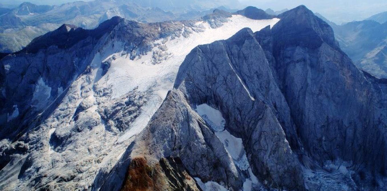
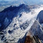
Their destination was Montlleó, a windswept terrace perched over the Cerdanya valley at 1,144 meters above sea level. Today it lies quiet in the municipality of Prats i Sansor, in northeastern Spain. But during the Last Glacial Maximum, Montlleó was a vital node in a trans-Pyrenean network. Flint tools left behind at the site1 tell a story of mobility, cultural identity, and the quiet ingenuity of Upper Paleolithic peoples who refused to be hemmed in by mountains or ice.
Stone Maps of Human Movement
More than 25,000 lithic artifacts have been recovered from Montlleó—flint flakes, blades, and cores, some chipped and spent, others pristine and ready for use. Among them are rare specimens that archaeologists traced to distant geological formations across modern-day France. A few fragments likely came from Chalosse, a region nearly 400 kilometers away in the southwest. These weren’t random rocks. They were hand-selected, transported, and exchanged—signifiers of distant homelands and enduring human ties.
“We now understand that the Pyrenees were not a boundary,” writes Sánchez de la Torre and colleagues, “but a permeable corridor traversed repeatedly by Magdalenian communities.”
By comparing flint artifacts from over 20 archaeological sites with geological samples from the Pyrenean flint formations, researchers mapped not only where humans traveled—but what they valued. The project, known as SPEGEOCHERT, combined field sampling with geochemical fingerprinting and GIS-based route modeling to reconstruct ancient movement patterns.
Crossing the Ice: How People Navigated High Mountains
During the Last Glacial Maximum, glaciers swept across the Pyrenees, locking large swaths of the range under thick sheets of ice. Still, corridors such as the Cerdanya valley remained viable. These routes were well known to Paleolithic hunter-gatherers. Rather than barriers, the mountains became meeting places—seasonal hubs for trade, communication, and cultural exchange.
Montlleó was one such hub. Excavations there suggest repeated short-term occupations, likely tied to hunting expeditions and intergroup contact. Alongside flint tools, archaeologists have recovered evidence of bone tools, hearths, and ornaments—many of them made from imported materials.
“Each projectile point was shaped for the hunt,” said co-author Xavier Mangado, “but the raw materials and typologies also marked group affiliation. They were social objects.”
Not all flint circulated equally. Certain varieties, favored for their quality or symbolism, appeared more widely than others. These “preferred flints” helped researchers trace not just individual journeys, but cultural routes—a shared mental map passed down over generations.
What Flint Reveals About Ice Age Life
By examining how far and in what form these flints traveled, archaeologists could identify distinct pathways across the mountains. Two principal corridors emerged: one in the east, following the Cerdanya valley, and another in the west through the Basque country. These routes remained in use for thousands of years, shaping the region’s prehistoric networks.
Flint wasn’t just a functional material. It was part of a larger toolkit for survival, memory, and meaning. The tools themselves—cores prepared for flake production, retouched blades, worn-down scrapers—bear the physical marks of hands at work. And their movement across the Pyrenees shows how Paleolithic people brought more than just tools with them. They brought traditions.
“The distribution of certain flints,” the authors note, “is more than a question of distance. It reflects choice, identity, and connectivity.”
Rethinking Human Limits
Archaeology often underestimates how far early humans traveled, or how complex their social worlds were. But the research at Montlleó is part of a growing body of evidence that challenges those assumptions. These Ice Age foragers weren’t simply reacting to the environment—they were shaping it, mapping it, and moving through it with intention.
In a frozen world, they climbed mountains to connect with others. They met in snowy valleys to trade, feast, and form alliances. And when they left, they carried with them not just meat and hides, but stories—chiseled into stone.
Related Research
Féblot-Augustins, J. (1997). La circulation des matières premières au Paléolithique. ERAUL.
Schmidt, I., & Zimmermann, A. (2019). Population dynamics and socio-spatial organization of the Aurignacian: Scalable quantitative demographic data for western and central Europe. PLoS ONE, 14(2), e0211562. https://doi.org/10.1371/journal.pone.0211562
Vaquero, M., & Pastó, I. (2001). The definition of spatial units in Middle Palaeolithic sites: The hearth-related assemblages. Quaternary International, 135(1), 93–103. https://doi.org/10.1016/S1040-6182(04)00079-3
Sánchez de la Torre, M., Rafart, E., González-Olivares, C., Gratuze, B., & Mangado, X. (2025). Long-distance movements during the Last Glacial Maximum in the Pyrenean mountain Range: Fresh insights for Montlleó archaeological site (Prats i Sansor, Cerdanya, Spain). Journal of Archaeological Science, Reports, 61(104905), 104905. https://doi.org/10.1016/j.jasrep.2024.104905


