
A Cave Steeped in Deep Time
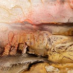
La Pileta Cave in southern Spain is more than a dark hollow in the limestone hills of Málaga province. Inside its twisting passages, walls shimmer with images painted and carved by Homo sapiens across tens of thousands of years—horses, ibex, serpentine symbols, and human silhouettes stretching back to the Upper Paleolithic and forward into the Bronze Age. Discovered in 1905 and protected as a Spanish National Monument since 1924, La Pileta has long been recognized as a “cathedral” of Iberian prehistory.
The cave also contains a remarkable archaeological sequence spanning more than 100 millennia. Among its finds is a small lamp with traces of pigment from the Gravettian period, thought to be one of the oldest lighting devices on the Iberian Peninsula. Yet until recently, no digital model captured the full extent of this site’s features in three dimensions.
A New Approach to Ancient Walls
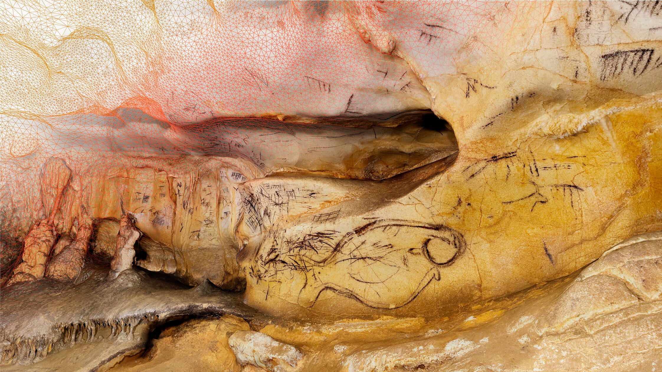
In a study published in the Journal of Archaeological Science1, a team from the University of Seville combined two types of laser scanning to map La Pileta Cave: a high-end terrestrial laser scanner and the LiDAR sensor embedded in an off-the-shelf smartphone. This pairing, at first glance improbable, allowed them to create a validated 3D model of the entire cave with remarkable precision.
“The complementarity of both systems made it possible to obtain a complete and validated 3D model, with minimum margin of error with respect to topographic reference points,” the researchers write.
While the terrestrial scanner provided a far-reaching, high-resolution metric backbone, the smartphone LiDAR excelled in tight, irregular passages inaccessible to bulky tripods. Its portability also allowed rapid data collection across multiple sessions.
“Using the mobile LiDAR offered versatility and access to narrow and difficult-to-reach areas, while still capturing high-quality textures,” the team notes.
What the Lasers Reveal
The resulting 3D model captures the morphology of the cave and the placement of its rock art—thousands of motifs spanning millennia. Animal figures, abstract symbols, and human silhouettes emerge as digital surfaces that can be rotated, measured, and explored virtually.
Scanning while suspended by rope 1. Credit: Journal of Archaeological Science (2025). DOI: 10.1016/j.jas.2025.106330
The model supports more than documentation. It opens the door to preventive conservation, allowing researchers to monitor erosion, vandalism, or humidity damage over time. It also provides a foundation for public outreach and immersive education, enabling students and visitors to experience a site closed or restricted to most travelers.
Caves as Living Archives
La Pileta’s new digital map underscores how caves serve as living archives of deep human history. Because such sites accumulate cultural layers over tens of millennia, their preservation and accurate recording are critical. By combining everyday technology with established field methods, archaeologists can now bring hidden spaces to light without disturbing them.
“This model reinforces and complements archaeological work, providing new tools for understanding, preserving and disseminating cultural heritage,” concludes the team.
Looking Forward
Smartphone-based LiDAR will not replace traditional fieldwork or high-resolution scanning, but it offers a nimble, low-cost complement for archaeological and speleological research worldwide. In regions where budgets or access limit large-scale surveys, pocket-sized laser sensors may extend the reach of documentation and democratize high-quality 3D recording.
Related Research
Forte, M., & Campana, S. (2022). “3D technologies for heritage and archaeology: A decade of progress.” Journal of Archaeological Science: Reports, 43, 103465. https://doi.org/10.1016/j.jasrep.2022.103465
Bruno, F., et al. (2020). “Virtual tours and rock art heritage: Immersive technologies for inaccessible sites.” Heritage Science, 8(1), 73. https://doi.org/10.1186/s40494-020-00414-y
De Reu, J., et al. (2013). “Applications of 3D recording in archaeology: The examples of Ghent University.” Journal of Archaeological Science, 40(12), 4450–4460. https://doi.org/10.1016/j.jas.2013.06.038
Antón, D., Mayoral-Valsera, J., Simón-Vallejo, M. D., Parrilla-Giráldez, R., & Cortés-Sánchez, M. (2025). Built-in smartphone LiDAR for archaeological and speleological research. Journal of Archaeological Science, 181(106330), 106330. https://doi.org/10.1016/j.jas.2025.106330


