

The Digonnière peatland sits at 1,055 meters in the Massif du Pilat, about twelve kilometers south of Saint-Etienne, a 2.4-hectare bog mostly covered in Scots pine (Pinus sylvestris), with a drainage ditch along its southern edge and the Semène River passing about 45 meters from the spot where a team led by Hugo Delile of the CNRS and Université Lumière Lyon 2 pushed a corer two meters down. What came up was black, moderately decomposed peat over an organic-rich sandy layer at the base, and the team named it Dig1Ter. Six thousand years of airborne dust are stacked in those two meters, and a share of that dust is lead from Roman lead mining.
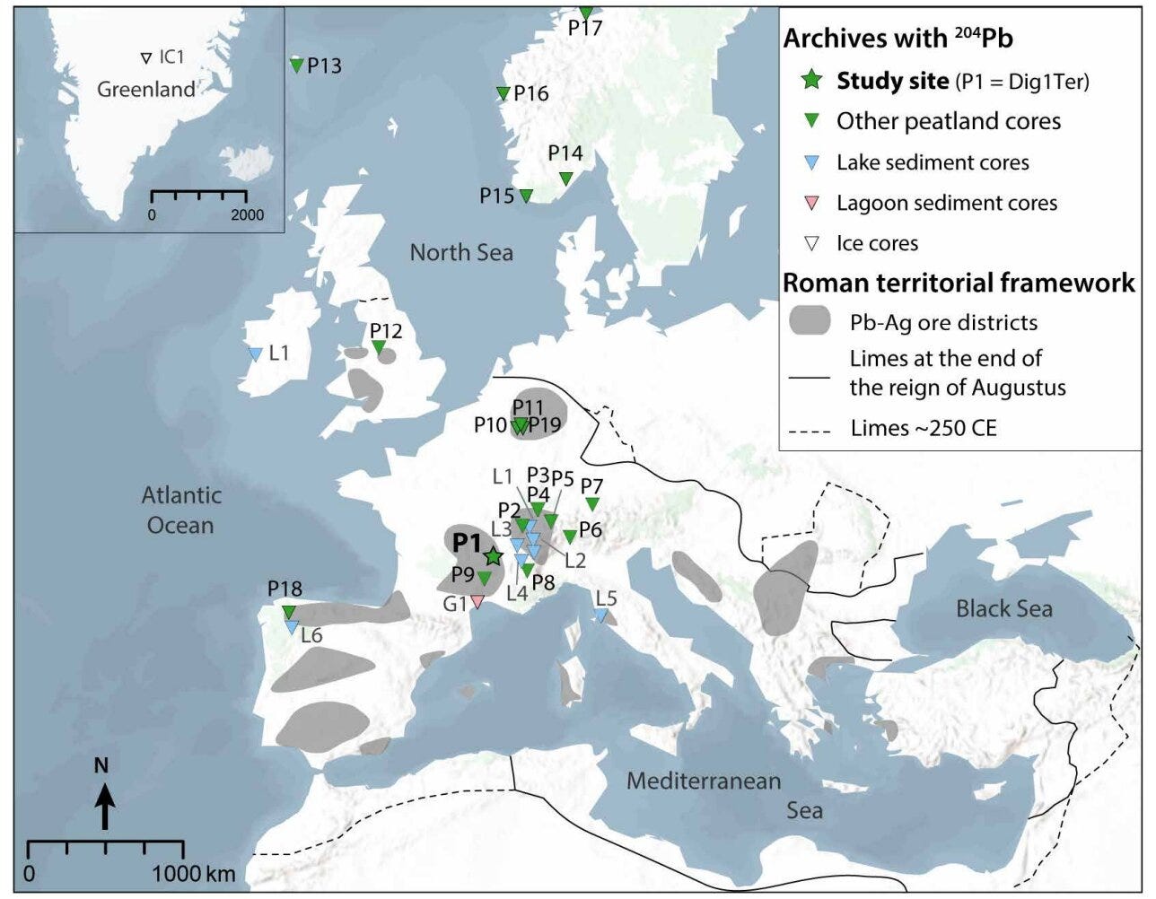
The usual account of that mining puts Hispania at its center. Polybius, Posidonius, Strabo and Diodorus Siculus all dwelt on the mineral wealth of Iberia, and the archaeology of Roman mines grew up leaning on them, so that the Iberian peninsula became the default answer for where the Empire’s lead and silver were dug. The peat gives a different answer. In a paper published in Science Advances1 in October 2026, Delile and colleagues, including Janne Blichert-Toft of the École Normale Supérieure de Lyon, report that lead fingerprints from 19 peat bogs across Europe line up, throughout the Roman period, with ore districts in the French Massif Central, the Rhenish Massif, the German uplands and Britain, while the Spanish districts of Cartagena-Mazarrón and the Sierra Morena barely register.
Lead matters for a reason that has little to do with lead. In nature it travels with silver inside the ore galena, and ancient smelters who roasted galena to get at the silver for coins sent a good part of the lead up the flue, where it drifted and settled on whatever was growing below. A bog that takes its water and dust from the sky keeps that fallout in order, layer on layer, and the lead in each layer carries the isotopic signature of the rock it was dug from. If you can read the signature, you can say which hills supplied the money.


