

On the floodplain of the Rio Blanco in southern Belize, an excavation unit designated RB14-02 was dug to 295 centimeters and abandoned there for reasons of safety and elbow room, with sediment still running beneath it. Five soil horizons lay in that column, two of them buried surfaces dark with organic matter, and the older ones held only a modest scatter of stone: three large chert flakes in a layer dated to between about 7,500 and 6,400 years ago, and above that layer two more flakes, a chert core and a fragment of burnt clay, dated to between 6,400 and 5,000 years ago. Charcoal ran through nearly all of it.
Most readers who picture Maya maize farming picture a hillside, a plot cut and burned out of upland forest, and many assume that growing maize and settling into villages arrived as a package. The team that dug RB14-02, led by Keith Prufer, professor of anthropology at the University of New Mexico, and Megan Walsh, professor of geography at Central Washington University, reports in Communications Earth & Environment1 that the first extensive maize farming in this valley took place on wet ground beside the river and a nearby swamp, by about 6,000 years ago (all dates here are calibrated years before present), and that it remained the dominant way of growing food for roughly 4,000 years. Farming reached the slopes around Uxbenká, the founding political center of the region, only after about 4,000 years ago, and for roughly 1,800 years the two systems overlapped.
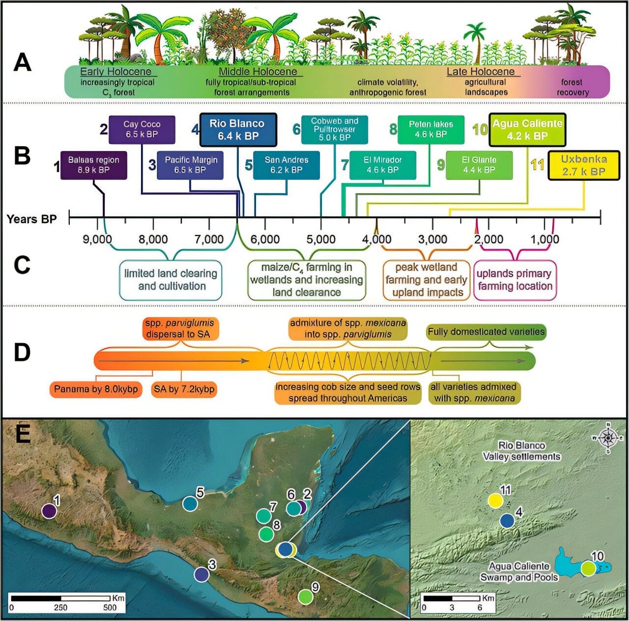
Moving a farm uphill in a country that receives more than 4,000 millimeters of rain a year is not an obvious decision, and the authors treat it as one that needed a reason. Floodplain soil stays moist through the dry months and is topped up with silt by every flood, which is why the earliest farming across Belize, Guatemala and southern Mexico turns up along lake, river and swamp margins. The reason they propose is a dry spell that shows up in a single cave record as a shift of 0.5 per mil in oxygen isotopes.


